Donors Gather for an Evening of Education: Nature Based Economic Development

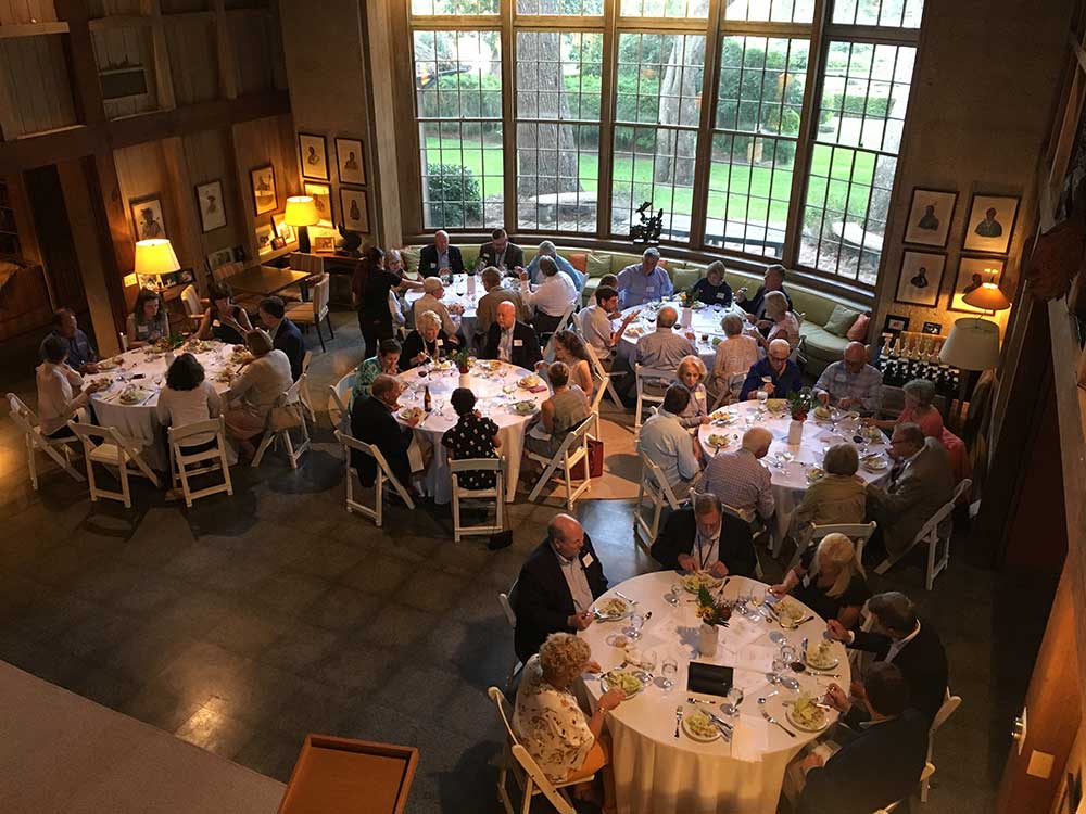
Co-hosted by Stewards of the Georgia Coast and the Communities of Coastal Georgia Foundation, the Conservation Donors Roundtable has become an annual tradition in the Golden Isles.  Roundtable hallmarks include an audience between 45 – 50 people, great fellowship and food, and an exploration of the intersection between private philanthropy and major conservation opportunities and challenges.  In each of the first three programs, speakers focused on conservation of iconic coastal wildlife. The 4th Annual dinner event, held in September at Musgrove Retreat and Conference Center, broke new ground with a look at nature-based economic development and, in particular, the construction of walking and bike paths across Georgia’s coastal region.

2019 keynote speaker Ed McMahon, the Charles E. Fraser Chair on Sustainable Development and Environmental Policy at the Urban Land Institute, presented the audience with a fundamental question:  should new development shape the character of the Georgia coast or should the character of the Georgia coast shape new development? Choosing the latter clearly implies choosing development that celebrates, preserves, and enhances the region’s cultural, natural, and community resources and, in particular, the coast’s distinctive landscapes.  This approach is often termed asset-based economic development and, more specifically, nature-based economic development.

McMahon highlighted successful communities across the country where leaders chose this route.  Common characteristics include the cultivation of a sense of place, distinctiveness, and quality of life for residents and visitors alike, in large part, by investing in historic town centers and outdoor amenities like walking trails and bike paths and protecting and enhancing nearby natural resources like parks, waterfronts, and other natural assets.  In a perfect segue to the evening’s second speaker, McMahon closed by observing that walking is the most popular form of outdoor recreation nationally. In fact, walking trails and bike paths have risen to the top of community amenities most sought by homebuyers (April 2014, National Association of Realtors/Homebuilders).

The Roundtable’s second speaker was Brent Buice, South Carolina & Georgia Coordinator for the East Coast Greenway, a non-profit organization working to connect 15 states and 450 cities and towns from Maine to Florida with an uninterrupted safe walking and biking route.  Not surprisingly, the proposed path through Georgia features the length of Georgia’s coastal region.  The good news is that nearly 100% of the proposed route is under public control.  The challenge:  most of the community level planning, fundraising, and construction needed to bring the coastal path to life is yet to be done.  That said, examples of high-quality bike paths already exist in coastal Georgia and they provide a foretaste of what’s possible.  Buice noted that where Georgia trails do exist, local communities have documented an uptick in visitors and business income attributable to people who are interested in getting off the interstate to experience nature at less than 70 mph.  From paths on St. Simons Island to recently constructed paths in Camden County, one can imagine the impact of having a path that connects the entire region and communities in between.  Private philanthropy will play a pivotal role in bringing that dream to fruition.

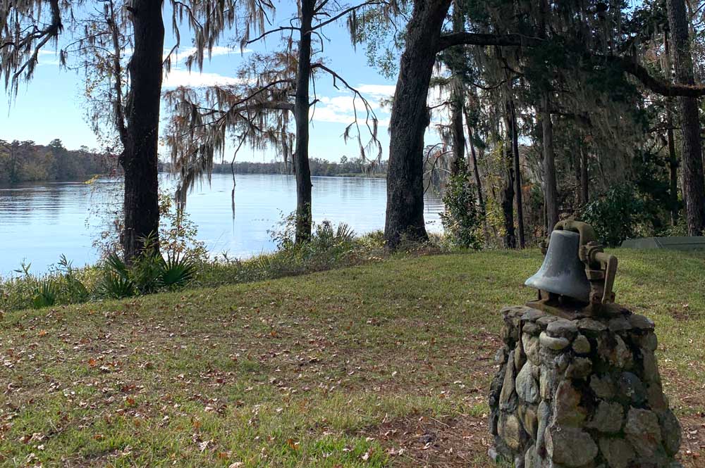
Following the tradition enjoyed by previous Roundtables, Georgia DNR’s Wildlife Conservation Section was well represented when Jason Lee provided an update on wildlife conservation in coastal Georgia.  Finally, the evening closed with a coastal donor speaking very personally about her philanthropic commitment to coastal Georgia born of her love of the outdoors and, in particular, her fondness for paddling the creeks and waterways of the region.  Marsha Certain, MD makes her home in Darien, Georgia where the Altamaha River is always in sight and a kayak is always near.  Marsha’s philanthropy and volunteerism merge with her service on the board of the Nature Conservancy in Georgia.

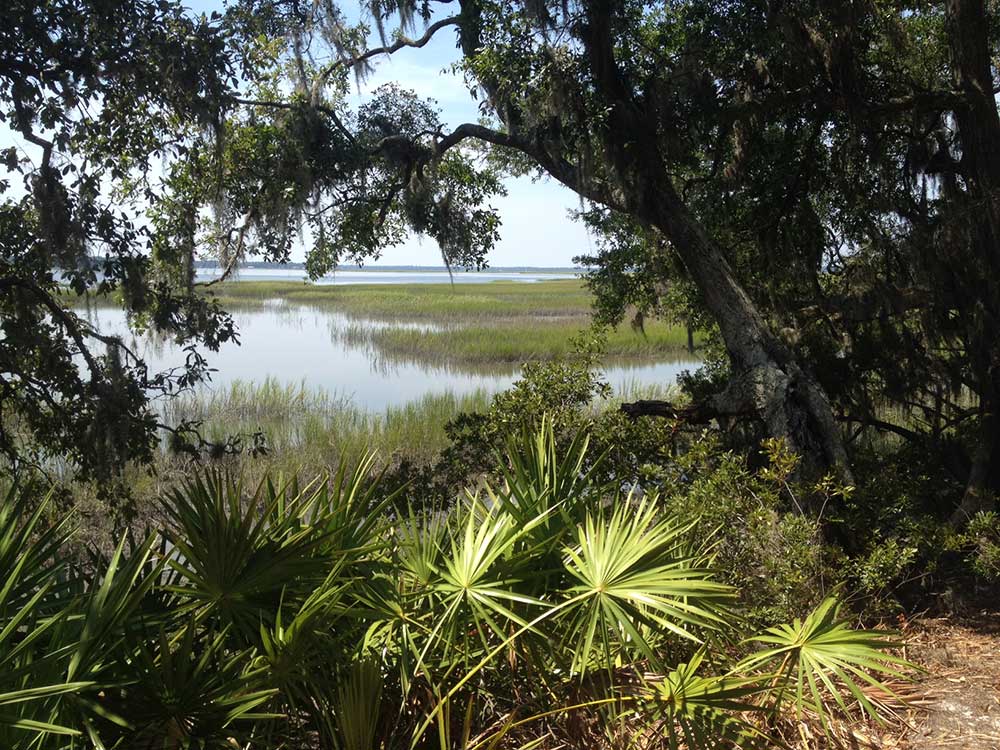
To be reminded that Georgia’s coast is an environmental gem, all a Roundtable participant had to do was gaze out of Musgrove’s windows onto the saltmarsh at sunset. Our coast’s biological, aesthetic, and cultural richness deserves nothing less than our best efforts in stewardship and philanthropy.

To learn more about Stewards of the Georgia Coast’s efforts to support sustainable development, green infrastructure, ecotourism and smart growth, please review our 2019 Coastal Conservation Project List. From The Nature Conservancy’s living shoreline pilots at Wormsloe and Harris Neck to the Georgia Conservancy’s sustainable community planning in Brunswick, there are great opportunities to get involved.

Capsized Vessel Endangers Marsh and Coastline Habitats

In 1879 the salt marshes east of Brunswick inspired Georgia poet Sidney Lanier to compose “The Marshes of Glynn,” a poem later memorized statewide by generations of Georgia schoolchildren. Undoubtedly, many of these children had never seen the marshes for themselves. But they carried with them Lanier’s vivid description of a day in the life of the marsh and his deep reverence for creation.   Unfortunately, since September 8, 2019, a great monolith has interrupted Lanier’s sweeping vista of the marshes bordering St. Simons Sound. The M/V Golden Ray, a 656-foot long car carrier, departed the port of Brunswick with 4,200 cars aboard only to suffer a fire, lose stability, and capsize just off the southern end of St. Simons Island. The cause is still under investigation.

Fortunately, all crew members were saved. Now comes the hard part: removing the ship from the busy channel along with all its contents — especially around 300,000 gallons of fuel, diesel, and lubricants carried by the ship and the gasoline and oil in its cargo of automobiles. Removing the ship’s fuel is particularly challenging because it is lying on its port side rather than upright. Imagine trying to accomplish that for an average car, half-submerged, but with a fuel capacity multiplied thousands of times.

The St. Simons Sound Incident Unified Command, an interagency response team of federal, state, and local agencies along with marine service contractors, moved quickly to skim leaking oil from surface waters, to place booms to protect sensitive marsh areas from oil coming ashore, and to plug submerged vents which began leaking fuel out instead of taking air in.  Despite their best efforts, fuel has been spotted along more than 30 miles of marsh and coastline and there were reports of oiled birds.

Three weeks after the capsize, the scene on the north end of Jekyll looked normal that afternoon.  People walked their dogs and picked up shells.  Others had set up shop by the waterline. Lounging in folding chairs, they hoped the incoming tide would bring a bite on their fishing rigs. But instead of seeing the St. Simons pier across the water, their view was the dull-red antifouling paint on the ship’s keel, topped by the navy-blue livery of its hull.  A busy flotilla of vessels swarmed around the ship. At the St. Simons pier, tourists and locals alike gathered to gawk at the spectacle of the Golden Ray’s white flat upper deck.

At the pier, I overheard one woman tell a companion that she had heard they were getting ready to right the ship, so she had hurried down to watch. She has a long wait ahead of her. In the weeks following my visit, major fuel leaks continued to challenge the response team, not only from the standpoint of water and air pollution but also in cleaning up oil that the tides sent deep into the marsh. By the end of October, the decision was made that the ship could not be salvaged. Instead it will be sliced vertically like a loaf of bread, from the bottom up. Once freed, each slice will be carried away for scrap. In the meantime, seagoing excavating equipment strategically placed a blanket of 6,000 tons of Georgia granite beneath the hull to resist the twice-daily ebb and flow of the tide shifting the sands beneath it — to hold the ship where it rests in the shallows alongside the channel.

Depending on your perspective, it’s fortunate that there are engineering firms which have the expertise to deal with this situation. Thus far in 2019, this is the sixth major incident involving a car carrier somewhere in the world. But each accident has its own challenges, and it will be months before work begins. And once it begins, new threats will emerge for our coast.

The Altamaha Riverkeeper (ARK),  One Hundred Miles (OHM), and other local environmental groups responded quickly to the incident and continue to monitor the area from land, sea, and air. They have enlisted the expertise of UGA microbiologist Dr. Samantha Joye, an expert on the impacts of oil in coastal environments. She continues her work on the 2010 Deepwater Horizon oil spill in the Gulf of Mexico. Now her expertise is being put to use closer to home to document and analyze this situation as it develops. The local groups continue to share their findings in collaboration with the interagency response team.

“This disaster is a reminder that our communities need to be prepared when catastrophe occurs,” says Megan Derosiers, president and chief executive officer of One Hundred Miles. “Groups like ARK and OHM stand ready to monitor and react to unplanned events, but more importantly, they work every day with local and state government officials to ensure plans are in place to respond to and prevent these incidents. We all must remain vigilant and informed about the Golden Ray’s impact on our wildlife and environment, the businesses who rely on it every day, and the residents who value their connections to it in so many ways.” Fletcher Sams, the Altamaha Riverkeeper’s executive director, echoes this sentiment, “Without being alarmists, we are trying to make sure our community is kept whole through this.”

That community encompasses more than coastal residents. All Georgians have a stake in ensuring there is minimal impact to this coast that belongs to us all. Or as Sidney Lanier described it, “the length and the breadth and the sweep of the marshes of Glynn.”

*****

The public may subscribe here for official updates from the St. Simons Sound Response; Click here for the Altamaha Riverkeeper’s map of oil impacts in the marsh.

Bill Strother, Steward of the Satilla

A native of Saint Simons Island, Bill Strother has a special vantage point from which to observe and enjoy the Satilla River: the high bluffs of 1700-acre Ivanhoe Plantation – a varied landscape of marsh, fallow rice fields, pine forest, and wetland hardwood nestled along two miles of Satilla River frontage. From his earliest years, Bill has wandered the woods and waterfront of Ivanhoe, delighting in its flora and fauna, and now he is dedicated to preserving it and its critical wildlife habitat for future generations.

In 1955, Bill’s father and a group of friends purchased Ivanhoe as a timber investment and duck hunting retreat. Ivanhoe’s rich history includes lore of William Bartram traversing it to reach the Satilla River. In the mid-1800s, Ivanhoe was among the largest rice plantations in Georgia. When the lumber business boomed in the years that followed, it housed a sawmill that employed over 400 people.

Today – thanks to the stewardship of Bill and his fellow Ivanhoe shareholders –  the sounds of sawmills have been replaced by the lonesome whistle of rare swallow-tailed kites, gliding on thermals above the old rice fields. They manage the quiet retreat for turkey and deer habitat and timber on the high ground and for waterfowl in the wetlands. Committed to protecting native wildlife and to restoring the natural ecosystems, in 2017 the Ivanhoe shareholders put 1400 acres under conservation easement managed by the Natural Resources Conservation Service (NRCS), an agency of the U.S. Department of Agriculture.

Working together with NRCS, Bill and his partners are protecting and cultivating a 150-acre impoundment that provides vital aquatic wildlife habitats. Beneficiaries of this conservation partnership also include the swallow-tailed kite, white ibis, wood storks, roseate spoonbills, bald eagles, many species of shorebirds and songbirds, and the waterfowl that prompted Bill’s father and his friends to purchase Ivanhoe so many years ago.

Listening to him speak about decades spent nurturing and enjoying Ivanhoe, you see Bill’s eyes sparkle with stories about catching catfish and about the fruits of reforestation efforts and timber management.  A few years ago, Bill took a Georgia Forestry Commission certification course to learn prescribed burning techniques necessary for propagation of longleaf pine forests and the survival of keystone wildlife species such as the gopher tortoise, an animal that – in turn –  creates necessary habitat for endangered and threatened species like the indigo snake, eastern diamondback rattlesnake, and gopher frog.

But Bill’s greatest joy seems to be in passing on this love of nature to the next generation.  In the spring, you may find him teaching his 8-year-old cousin, George, how to cut a firebreak and use a drip-torch in the longleaf pine forest; in the fall you may find him showing his 2-year-old granddaughter, Ansley, how to navigate a pontoon along the Satilla. Bill’s most enduring legacy at Ivanhoe may yet be the example of stewardship he sets by dedicating time, talents, and resources to protecting, preserving, and nurturing our Georgia coast.

Land Protection on the Satilla: An Update on Cabin Bluff

Cabin Bluff, approximately 11,000 acres located three miles south of the mouth of the Satilla and adjacent to Cumberland Island, is a lush, highly diverse landscape of salt marsh, tidal creeks, pristine maritime forests and fire-managed pine flatwoods.  This large, high elevation, undeveloped portion of the Georgia coast – a critical portion of the Atlantic flyway for migrating birds and an important site for ecosystem resilience and adaptation as sea levels rise — was zoned for 10,000 residential units and over one million square feet of commercial development.  Instead, The Nature Conservancy, the Open Space Institute, and private donors joined together in 2018 to remove this historically and ecologically significant property from the market and to work toward its long term protection.

During its interim ownership of the property, The Nature Conservancy is partnering with Georgia DNR to develop and initiate plans to manage the forest, fostering healthy environments for gopher tortoise, indigo snake, and other inhabitants of the imperiled longleaf pine ecosystem. With the conservation of Cabin Bluff, the Gopher Tortoise Initiative draws ever closer to its goal of permanently protecting 100,000 acres of gopher tortoise habitat across Georgia’s coastal plain and preventing the reptile’s listing as an endangered species.

Marketing efforts are underway to identify a conservation buyer for the historic recreational portion of the Cabin Bluff property.  This compound of cabins, conference center, and sporting amenities is one of the oldest hunting clubs in the country and once hosted President Calvin Coolidge.  The long-term vision for Cabin Bluff is its permanent protection through conservation easements and for a portion of the property to be open for public access. For more information, click here.

In related good news, Ceylon, the 16,000 acre property neighboring Cabin Bluff, was purchased recently by the Conservation Fund and Open Space Institute. Over the next few years, the organizations will work with Georgia DNR and federal agencies to permanently protect the area under conservation easements. For more information, click here.

Restoring the Historic Satilla

By Dorinda Dallmeyer

Like all of Georgia’s coastal rivers, the Satilla has served as a pathway to the interior for hundreds of years. The early Native Americans hunted in its rich forests. In the 1500s, the French explorer Jean Ribault called it “Riviere Somme,” a name honoring a similarly tranquil river flowing through French Picardy. The Spanish, who set up a chain of missions along the southeastern coast, named it St. Illa in memory of one of their officers. With the defeat of the Spanish, the English fur traders kept that name but anglicized it into its current pronunciation.

Regardless of what it was called, the Satilla provided the avenue for goods to move upstream to settlers’ outposts and a way to bring goods to market. From the mid-1700s to 1860, the Satilla’s bottomlands nurtured a tidewater rice culture whose productivity rivaled the tonnage produced in the Savannah area. After the Civil War, the logging industry used the Satilla to transport timber downstream for export around the world. As a vital waterway for trade, the Satilla was not immune to human interventions designed to speed up the transit of traffic upstream and down.

One example is in the Satilla estuary where, from 1900 to 1939, eight shortcuts were made between natural channels to increase the accessibility to tidal creeks for the timber industry and to provide a safer inland route for small watercraft. Because these cuts altered tidal flow and the course of the river itself, portions of the Satilla began to fill with sediment. Additionally, changes in salinity adversely affected migratory fish, shrimp, and shellfish which formerly supported a valuable commercial and recreational fishery.

To address these ecological and economic impacts, the U.S Army Corps of Engineers (USACE) collaborated with state and local groups to assess the feasibility of restoring the Satilla to its former flow regime. In June 2018, the Corps released a study evaluating the closure of Noyes Cut, a shortcut originally created as part of the Intracoastal Waterway but which was obsolete as far back as 1939. By halting sedimentation in the tidal creeks, both fish and boats once more could have access to the upper reaches of the estuary at low tide. Additionally, the restoration of normal saltwater gradients would improve habitat for migratory and resident fish, crabs, and shrimp, and restore over 4,500 acres of essential fish habitat.

The total project cost is $7.6 million, with the Corps contributing 75 percent and a required 25 percent non-federal match of $1.9 million. The Satilla Riverkeeper has applied for a “Conserve Georgia” grant through the DNR’s Georgia Outdoor Stewardship Program to help with the Noyes Cut restoration costs but still seeks support for the project from private donors. Donated funds can be spread over a three-year period. If you are interested in supporting this highly collaborative project whose goals align the interests of local residents and fishers, the environmental community, fisheries managers, and USACE, please contact Laura Early at (912) 462-5094 or riverkeeper@satillariverkeeper.org.

Georgia’s Coastal Watersheds, Part IV: The Satilla

Georgia’s Coastal Watersheds, Part IV: The Satilla

By Dorinda Dallmeyer

Rising from a lake four miles east of Fitzgerald, the Satilla River winds over 260 miles in extravagant loops across the Coastal Plain until it meets the Atlantic at St. Andrews Sound between Jekyll and Little Cumberland Islands. Because its 4,000 square-mile watershed lies wholly within the Coastal Plain, the Satilla carries little of the sediment that characterizes coastal rivers to its north. Instead its waters are clear, stained a dark brown with tannins washed in from rich floodplain forests of stately bald cypress and tupelo and the bordering pinelands. In the Satilla’s upper reaches, white sand shoals gleam along its meanders, brightening the dark waters flowing over them. Closer to the coast, ocean tides change the river’s flow far inland. It’s stunning to stand on the Satilla’s banks to witness the river diligently flowing “uphill” fifty miles upstream of its mouth only to watch it reverse course a few hours later.

Because the watershed is sparsely populated, the Satilla faces fewer impacts from urban development along its length than other coastal rivers. Its beauty and mosaic of habitats rich with wildlife have stimulated the growth of ecotourism, especially in the form of recreational paddling.  With the cooperation of state and county agencies as well as the non-profit sector, the Satilla River Water Trail now stretches 140 miles, from Jamestown Landing to Woodbine. In addition to paddling, the Satilla has long been renowned for its sportfishing, both for freshwater fish and in its estuary.

The Satilla Riverkeeper serves as the watershed’s lead caretaker. Riverkeeper Laura Early describes her organization this way: “We are the eyes and ears of the watershed. Because the Satilla is not very densely populated along much of its length, we have a much more intact river environment to enjoy. On the other hand, it’s more difficult to keep tabs on water quality without the assistance of our whole community, whether it’s conducting routine monitoring or responding quickly to any problems that may arise. The value of a local Riverkeeper is having a professional organization dedicated to serving as a focal point for information and action. The support of donors to our general fund for our day-to-day work means we are here all year round, devoting our time, energy, and attention to stewardship of this precious resource.”

According to Early, “Working with Georgia Adopt-a-Stream, we are training residents to become enthusiastic and dedicated citizen-scientists who conduct water quality monitoring in their own backyards and across the watershed.  We offer an interactive watershed education program to cultivate the next generation of river stewards. And we are working to increase the capacity of local governments to incorporate environmental issues into their planning processes.”

While the rural nature of much of the watershed works to its advantage, many of the higher-growth areas of the basin are doubling in population every twenty years. In the absence of adequate zoning regulations and infrastructure, poorly-regulated development can adversely affect the economic, environmental, and cultural values the Satilla provides. As Laura Early puts it, “For so many people here, the Satilla is woven into their lives. It helps define who they are. They want to ensure the river has that same positive influence for generations into the future, and they are willing to work for this river which has given them so much.”